
GIS AND SURVEYS
TMS offers a wide range of GIS solutions for business, researchers and development organizations. The core areas of GIS services offered by TMS are outlined below.
• GPS,
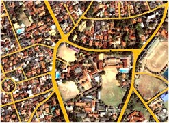
satellite imagery, and topography mapping
•
Competitor/customer mapping & analysis
• Vulnerable/ sensitive area identification
• Fully customized GIS/mapping solution• Surveys
Contact us for further information on GIS services.
• GPS,
satellite imagery, and topography mapping
TMS
has a comprehensive in house GIS data collection including socioeconomic,
infrastructure, elevation data, etc. In
addition, TMS can undertake data collection necessary for the assignment
undertaken. The company has the capacity to perform GPS, satellite imagery
and/or topography mapping to suit the requirements of the client.
•
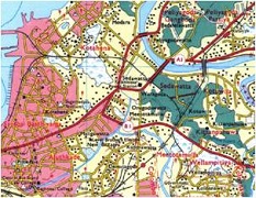
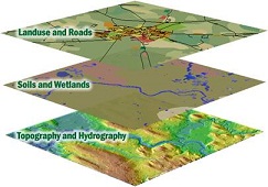
Site selection and feasible area assessment
TMS
GIS technology can facilitate site selection and feasible area assessment by
modeling scenarios taking into account all contributing factors (e.g.
topography, water availability, population densities, infrastructure, etc.) and
potential impacts of projects. This kind of analysis can support accurate
decision making when carrying out site selection. This technology strengthens decision making
capacity especially in areas such as new infrastructure development, setting up
of industries, locating dumping sites, etc.
Back to top
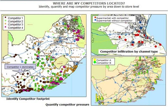
•
Competitor/customer mapping & analysis
Competitor/customer mapping and analysis is particularly useful to the corporate sector. Ability to comprehensively accurately map and analyze customer competitor data can be a powerful tool for business strategy development.
•
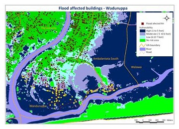
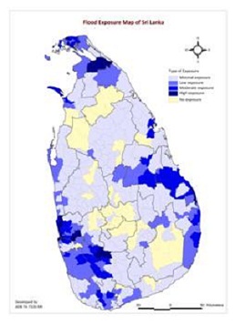
Vulnerable/ sensitive area identification
Vulnerable/ sensitive area identification is a useful
GIS tool that can be used in a range of disciplines including environment,
health and water among others. This
efficient and accurate tool has commonly been used in Disaster Risk Reduction/Management.
It is also a very powerful tool in areas such as disease control (with vector
mapping), biodiversity conservation (mapping of sensitive areas and hotspots),
and water quality mapping.
Back to top
• Impact Analysis
Impact analysis is a useful and accurate tool in
assessing current impacts and potential future impacts due development
activities, disaster events or any physical intervention.
Back to top
Fully
customized GIS/mapping solutions
In addition to services explained above, TMS is geared to provide fully customized GIS/mapping solutions to meet your needs. We undertake work in any of the following areas:
- Health
- Agriculture
- Transport
- Catering services
- Property management (Land and housing sale)
- Engineering
- Finance
- Facility and infrastructure management
- Education
Surveys
TMS undertakes socioeconomic surveys and offers:
- Survey design
- Field surveying
- Database development and data entry
- Data analysis and mapping
- Report writing